Construction Drone Photography in Victoria, BC: What It Actually Looks Like on a Real Job
Construction drone photography sounds pretty simple until you actually show up to an active construction site.
“Get some aerial photos of the building.”
Sure.
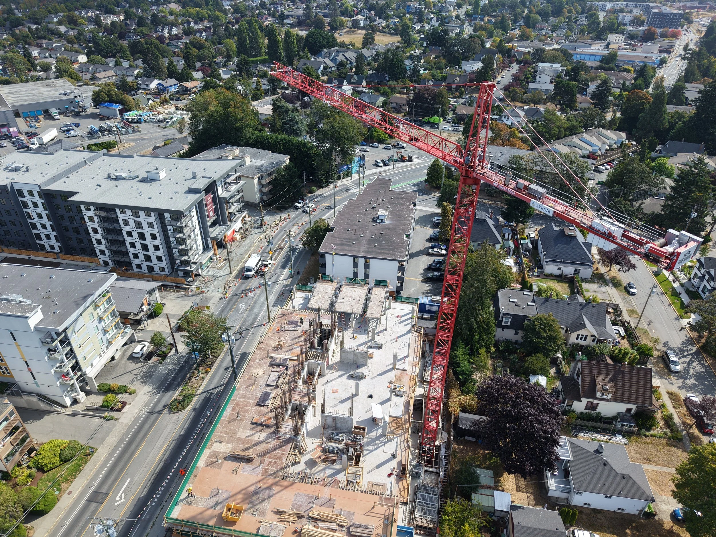
Then you arrive and there’s a crane moving, workers on site, equipment shifting around, traffic nearby, power lines, buildings on every side, and suddenly your nice tidy little flight plan has become more of a suggestion.
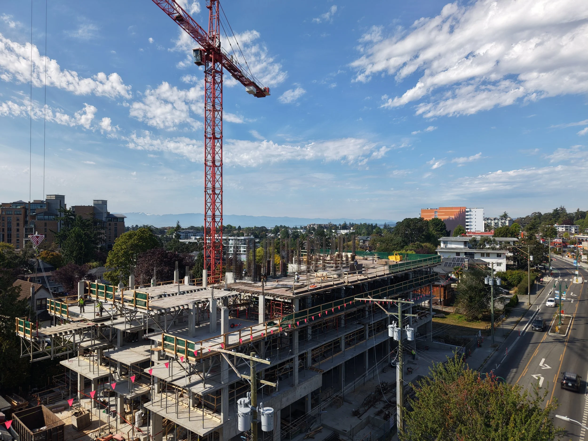
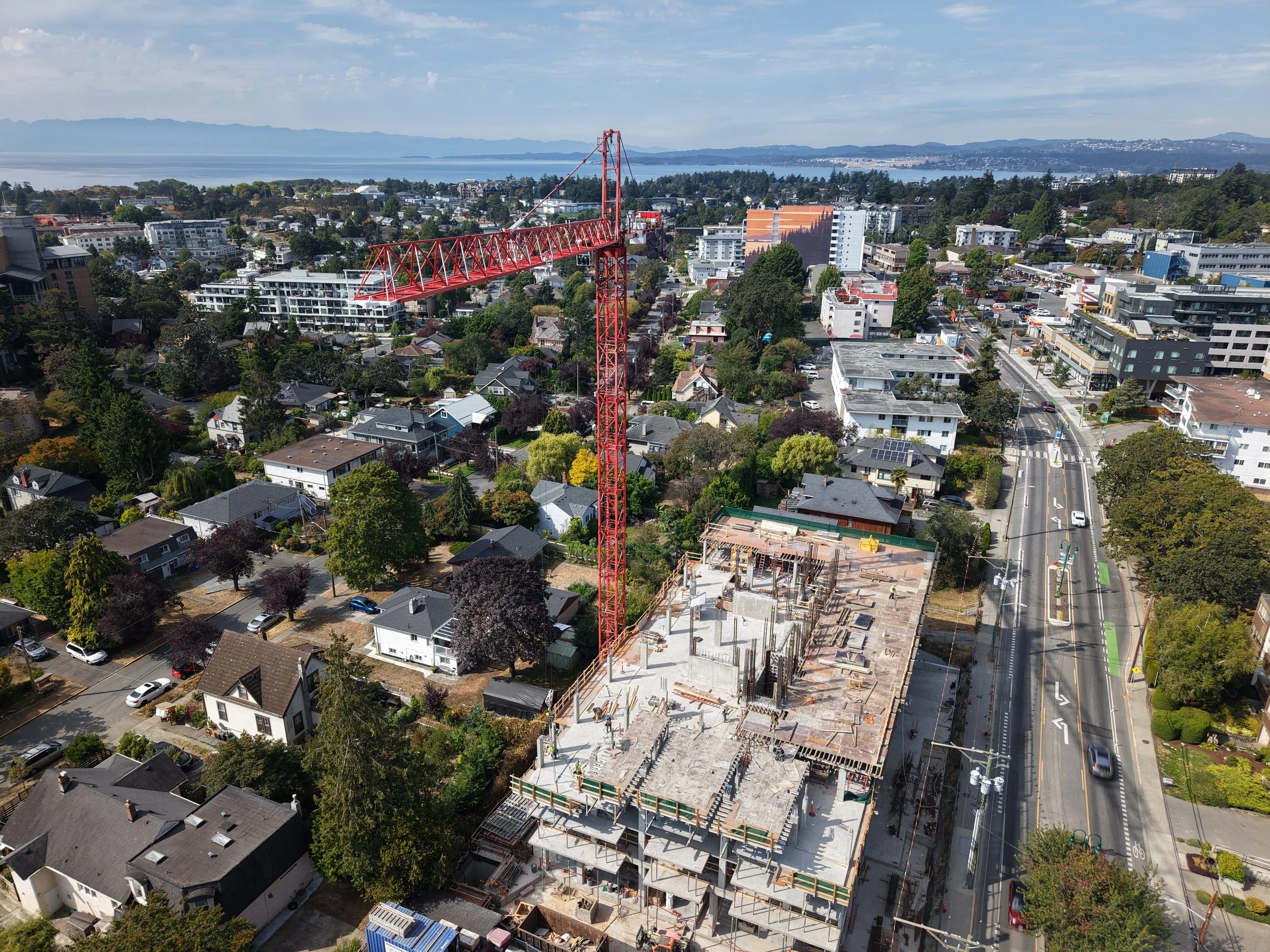
That was pretty much the reality on a recent shoot for The Horizon, a new development in Victoria.
The job was a good example of what construction drone photography can actually involve, and why it’s a little different from showing up at the beach, sending the drone up, and chasing nice light.
Vancouver Island Drones provides construction progress photography and aerial documentation for projects throughout Greater Victoria, including repeat visits, consistent viewpoints, site overviews and marketing imagery.
The Goal Wasn’t Just “Take Some Drone Photos”
For this project, the developer needed more than a handful of pretty aerial shots.
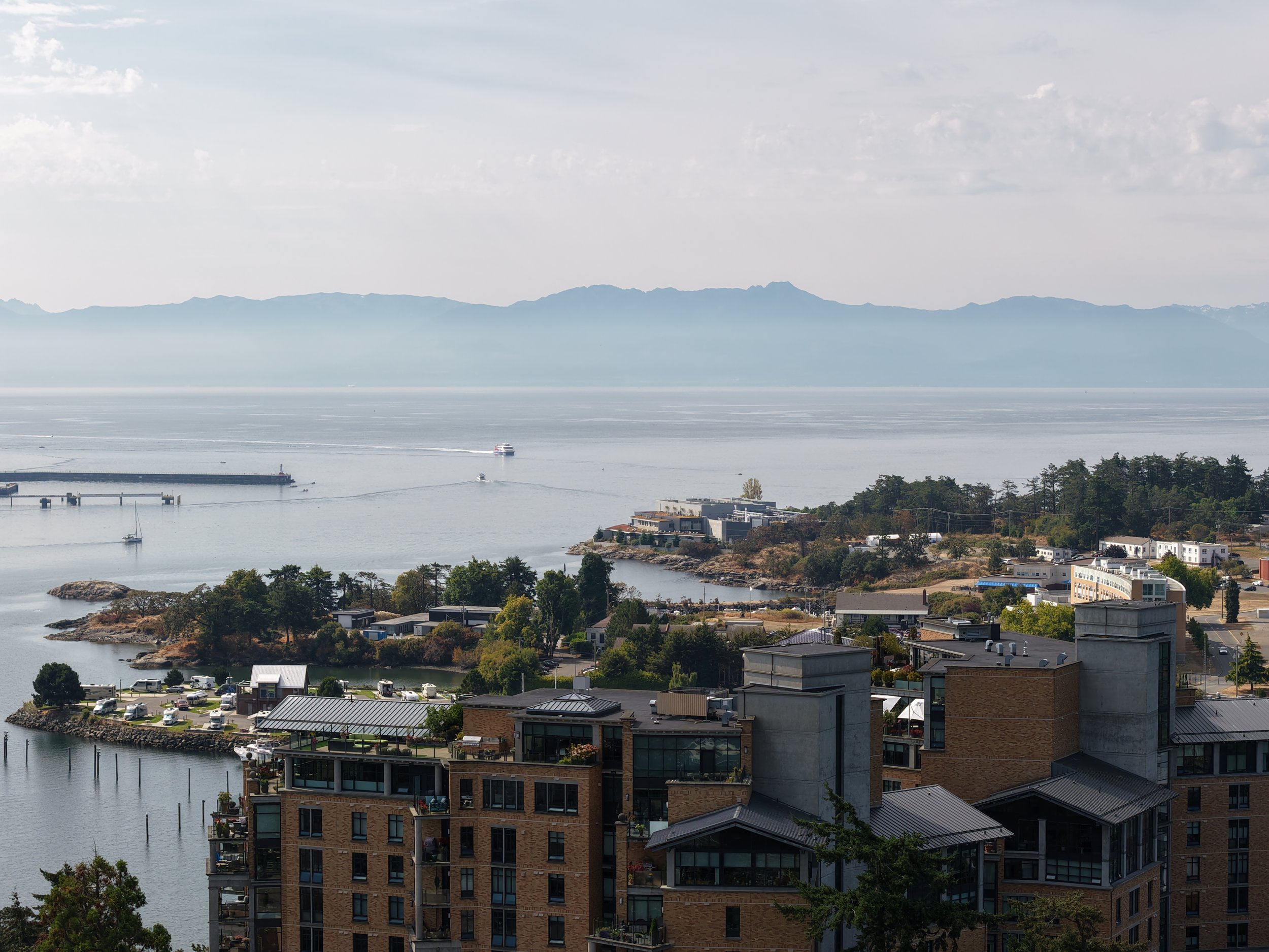
Part of the job was capturing representative views from different future floor elevations so the images could be used for marketing and rendering work.
That meant flying the site at multiple heights and photographing the surrounding views from different sides of the building.
On paper, that sounds wonderfully organized.
6 Levels
Nice and neat.
Reality, as usual, had other ideas.
The building was still under construction, the site was tight, and there was a lot of crane activity happening while we were there. So the job became less about blindly following a spreadsheet and more about adapting safely while still getting the images the client actually needed.
Construction Sites Are Busy Places
This is probably the biggest difference between construction drone work and a lot of regular aerial photography.
You’re not operating in an empty field.
You may be dealing with:
cranes
workers
lifts
vehicles
power lines
nearby buildings
traffic
changing site access
restricted launch areas
controlled airspace
and whatever else decides to happen that morning
The drone is only one small part of the operation.
For The Horizon shoot, there were active crane lifts happening while we were flying, so there were times when the correct decision was simply to wait, reposition, or change the shot.
There is no photograph worth getting stupid over.
Future-View Photography Is an Interesting One
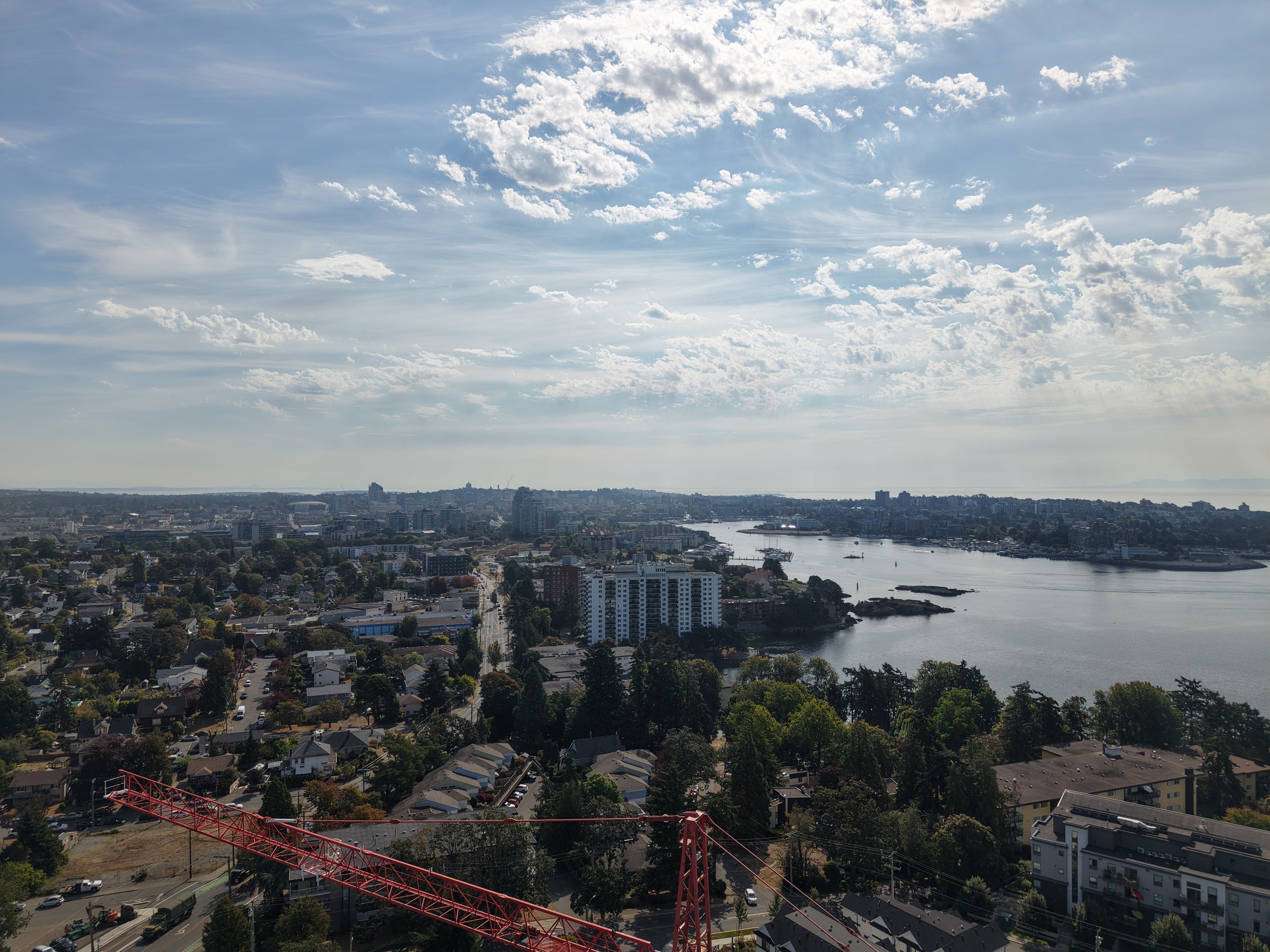
One of the more unusual parts of this project was photographing views from floors that do not exist yet.
The idea is pretty straightforward: place the drone approximately where a future balcony, window, or residential floor will eventually be and photograph what the view will look like.
Developers can then use those images for sales material, presentations, rendering reference, or internal planning.
It’s also one of those jobs where you learn something pretty quickly:
Three metres sounds like a lot until you look at the photographs.
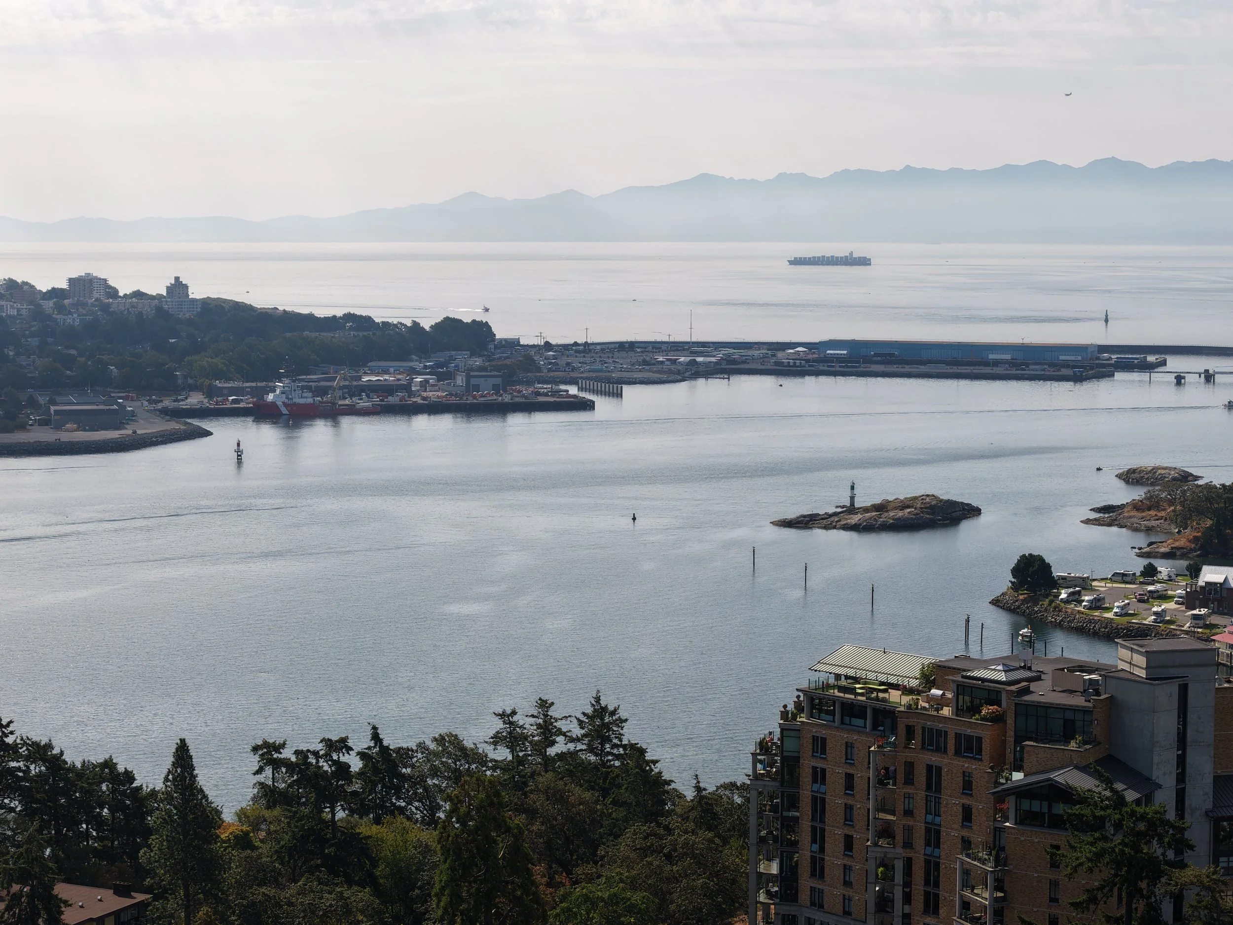
When the main subjects are mountains, ocean, skyline, or distant neighbourhoods, moving the drone up one storey does not necessarily transform the view.
Sometimes Floor 6 and Floor 7 look remarkably similar.
The bigger changes tend to happen when you start clearing nearby rooftops, trees, or buildings.
On this particular site, some of the surrounding views became much more interesting as we reached the upper floors.
That is useful information in itself.
Drone Photography for Construction Progress
Future-view photography is only one use for drones on a construction project.
Regular aerial photography can also be useful for:
Construction progress
A consistent aerial view makes it much easier to document how a project changes over time.
That can mean monthly photographs, milestone visits, or simply occasional updates when something significant happens.
Site documentation
Sometimes the goal is not glamorous at all.
You just need a clear visual record of the site from above.
And honestly, those are often some of the most useful photographs.
Developer and investor updates
Aerial images can show the overall scale of a project much better than ground photography alone.
They’re useful for presentations, internal updates, websites, social media, and stakeholder communication.
Marketing content
Construction sites may not always be beautiful, but they tell a story.
A crane working over a new development, concrete being poured, floors rising, or a building beginning to take shape can make excellent marketing material when photographed properly.
Commercial property photography
Once construction is finished, aerial photography can show access, surrounding neighbourhoods, nearby amenities, waterfront, roads, parking, and the relationship between the property and the area around it.
The Pretty Shots Still Matter
Even on a technical or documentation-heavy job, we still try to come home with something that looks good.
Because eventually somebody is going to want a website banner.
Or an Instagram post.
Or a brochure.
Or a photograph that doesn’t look like it belongs in an engineering report from 1997.
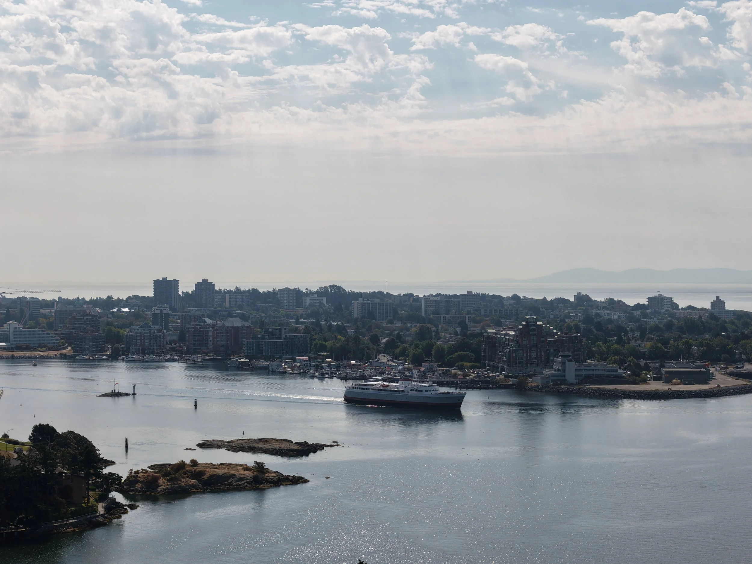
For The Horizon, once the required views were captured, we also spent some time looking for broader aerial images of the project, the surrounding neighbourhood, Victoria, the water, and the skyline.
That combination is usually the sweet spot:
Get the practical shots first. Then get the ones people actually want to look at.
Construction Drone Photography Takes a Bit More Planning
Every site is different.
Some are easy.
Some definitely are not.
Before a commercial construction flight, we look at things like:
the location
surrounding airspace
nearby obstacles
site access
launch and landing areas
people and equipment
weather
flight restrictions
NAV CANADA requirements where applicable
and what the client actually wants delivered
Vancouver Island Drones is Transport Canada Advanced-certified and insured, and commercial flights are planned around the real conditions on site.
Sometimes the original plan works perfectly.
Sometimes you arrive, look around, and think:
Well. This is going to be interesting.
That’s part of it.
Need Construction Drone Photography in Victoria?
Vancouver Island Drones provides aerial photography and video for construction projects, developments, commercial properties, job sites, and businesses throughout Greater Victoria and Vancouver Island.
That can include:
construction progress photography
future-view photography
development marketing images
commercial aerial photography
site documentation
raw aerial photos and video
organized project imagery
promotional video and photography
Every construction project is different, so pricing depends on the site, the scope, and what you actually need captured.
If you have a project in Victoria or elsewhere on Vancouver Island, send me the location and a quick explanation of what you’re trying to capture.
I’ll tell you what makes sense.
Ryan
ryan@vancouverislanddrones.ca
Related Reads
Construction Drone Photography in Victoria: Simple Progress Photos From Above
How repeat aerial photos can help document a project over time, show progress clearly, and give owners, contractors, and developers a useful visual record from above.
Hiring a Drone Pilot in Victoria, BC — What It Costs and What You Get
Straightforward pricing, what’s included, and what the process looks like if you need aerial photos, video, inspections, or a better look at something from above.
Drone Photography in Victoria, BC
A simple overview of the kinds of commercial and local drone work we take on around Greater Victoria, from businesses and properties to projects and job sites.